The Gemini Visual Acuity Experiments: A Look from Orbit
Following astronaut L. Gordon Cooper Jr.'s claims of spotting fine details on Earth from his Mercury-Atlas 9 spacecraft in 1963, including cars and smoke-spewing trains, a debate arose. Vision experts questioned whether astronauts with 20/20 vision could discern objects less than 150 feet wide from an altitude of 100 miles. Cooper, possessing exceptional 20/12 vision, insisted he saw a white car near the U.S.-Mexico border, a claim echoed by other Mercury astronauts regarding striking terrestrial details.
These assertions led mental health professionals to question the astronauts' sanity, with some speculating that weightlessness induced hallucinations. Meanwhile, vision scientists devised experiments to verify the astronauts' claims. NASA, in collaboration with partners, conducted two visual acuity experiments during the Gemini V and Gemini VII missions.
The first involved astronauts using a binocular-like device to identify the orientation of rectangles presented with varying contrast. The second, and more ambitious, experiment involved creating massive terrestrial eye charts. These charts, constructed from enormous white rectangles ranging from 150 to 600 feet in length, were placed in Laredo, Texas, and near Carnarvon, Australia. Astronauts on Gemini V and VII were tasked with identifying the orientation of these "Eye-Q" charts from orbit.
Despite challenges such as cloudy weather, sunlight glare from spacecraft windows, and unfavorable orbital positions, astronauts on both missions managed to observe parts of the Laredo site. Their reports, alongside the results from the vision testing instruments, confirmed that astronauts could indeed discern roads and ships with wakes from orbit. Crucially, these experiments also demonstrated that astronaut vision did not degrade during a two-week spaceflight.
The findings from the Gemini visual acuity experiments extended beyond simply validating astronaut observations. Understanding the extent of human visual perception from orbit had significant implications for Earth science. Geologists, geographers, oceanographers, and others studying our planet recognized the potential of high-resolution Earth imagery. This realization, coupled with the compelling photographs and accounts from the Mercury and Gemini missions, spurred the development of dedicated Earth-observing instruments. Organizations like NASA, the U.S. Geological Survey, the Office of Naval Research, and the U.S. Department of Agriculture saw the value of overhead imagery for tasks such as crop assessment, geological mapping, natural disaster monitoring, and understanding oceanographic processes.
The potential applications of Earth observation from space directly influenced the creation of the Earth Resources Technology Satellite (ERTS), later renamed Landsat 1. Launched by NASA in 1972, Landsat 1's instruments, along with data from the Earth Resources Aircraft Program, revolutionized how scientists monitored oceans, agricultural lands, disaster sites, and more. In the decades since these pioneering human spaceflights, NASA has continued its commitment to observing Earth from various platforms, seeking solutions to challenges on our home planet.
Fresh materials — MMA
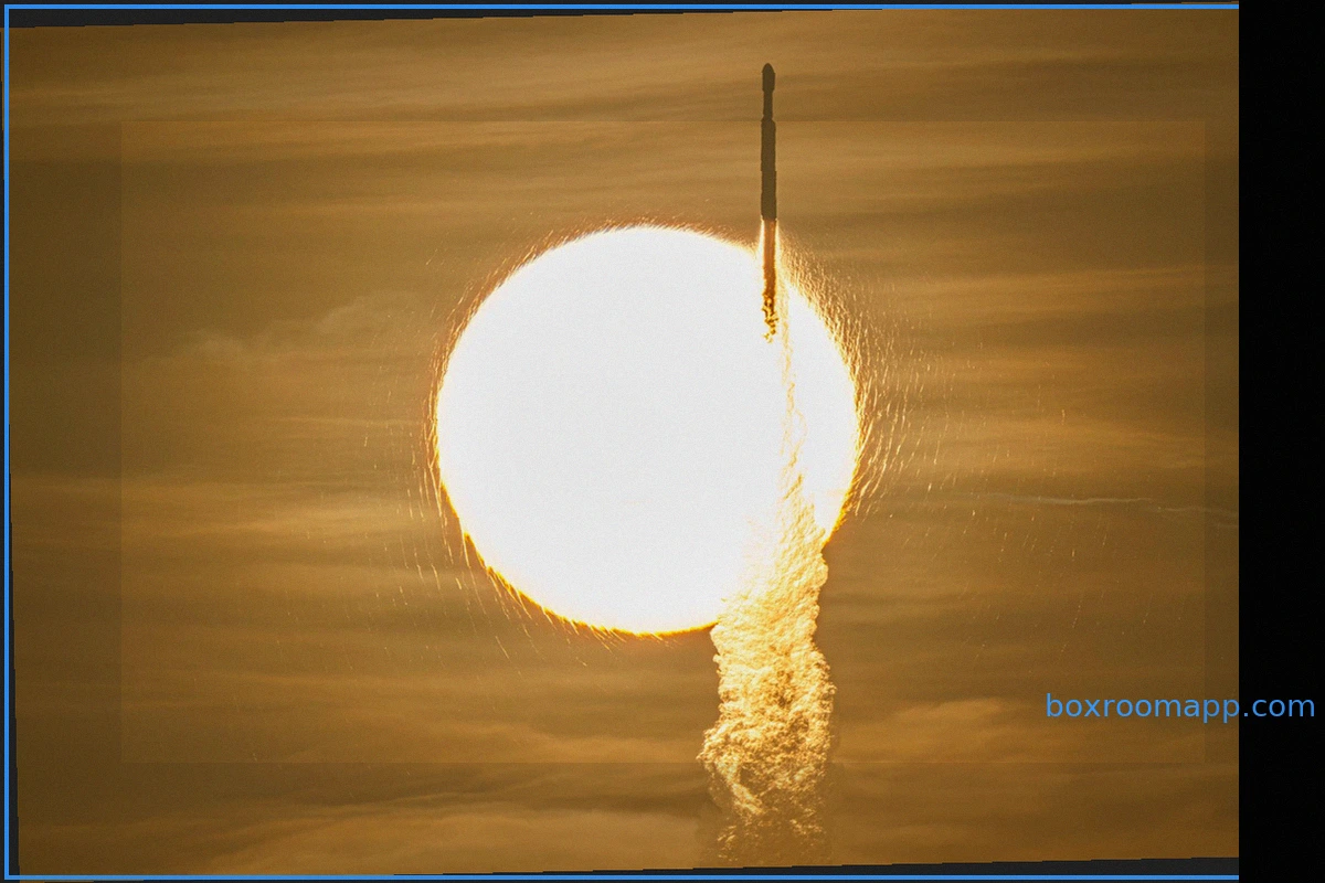
NASA's Nancy Grace Roman Space Telescope Launched to Explore the Dark Universe
NASA's Nancy Grace Roman Space Telescope has embarked on a three-month, million-mile journey to its designated orbit, poised to unlock the universe's most profound mysteries. The mission commenced its voyage on Sunday at 7:26 a.m. EDT, propelled by a SpaceX Falcon Heavy rocket from Launch Comp
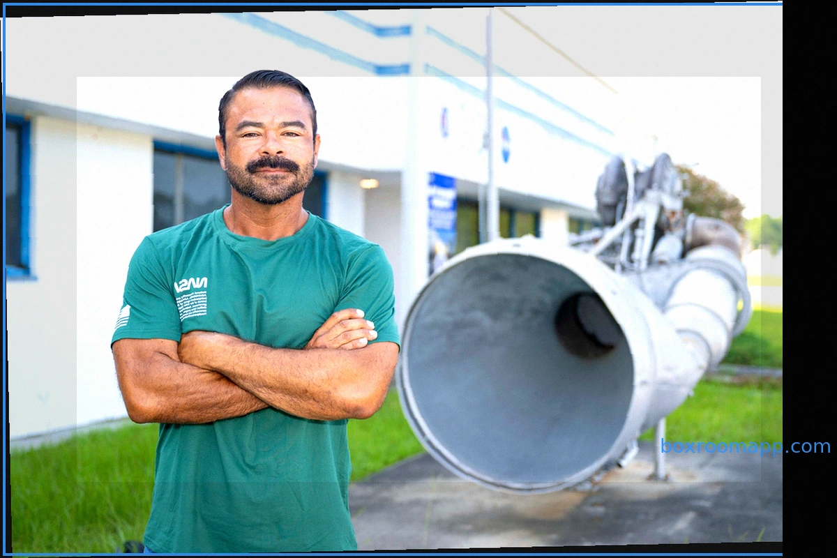
NASA Welcomes Jeret Howard as a Civil Servant
Jeret Howard, a logistics management specialist at NASA’s Stennis Space Center, has transitioned from a long-time contractor to a civil servant. This move signifies a continuation of his commitment to national service, mirroring his early dedication as a U.S. Army combat medic at
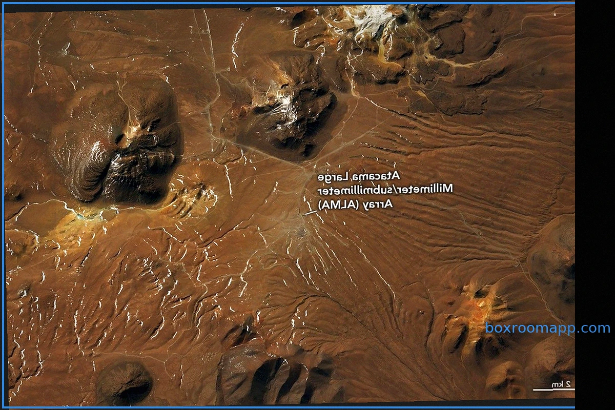
Rare, Widespread Snowfall in the Atacama Desert
In August 2026, consecutive winter storms brought an unusual snow cover to parts of the Atacama Desert in northern Chile. While the region has experienced snowfall before, notably in 2025 and 2011, one of the 2026 events was exceptionally extensive, reaching from the Andes mountains towards th
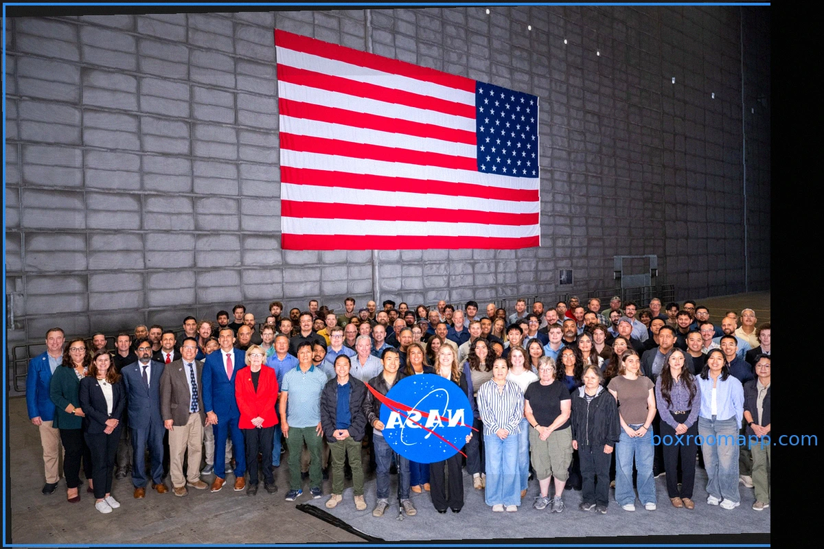
NASA Ames Hosts Largest Civil Servant Swearing-In Ceremony
Brandon Torres Navarrete On August 24, 2026, a significant group of new civil servants and their guests gathered for a
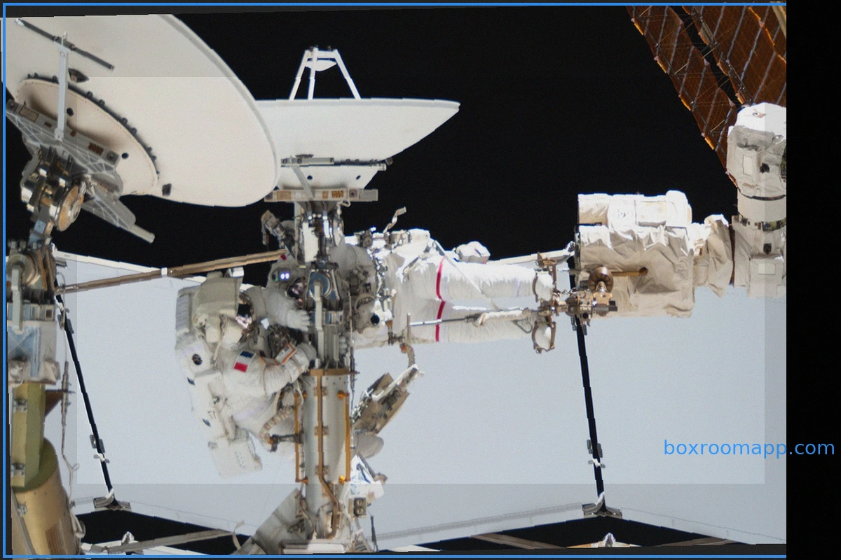
Astronauts Anil Menon and Sophie Adenot on Spacewalk
Astronauts Anil Menon of NASA and Sophie Adenot of the European Space Agency (ESA) participated in a spacewalk on August 18, 2026. The Extravehicular Activity (EVA) lasted six hours and 23 minutes and took place outside the International Space Station (ISS). During this spacewalk, the two f
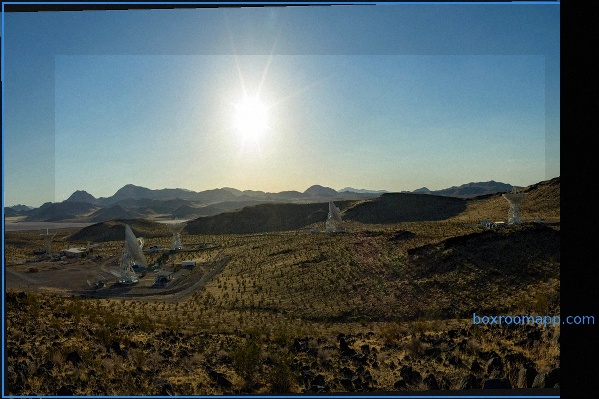
New Next-Gen Dish Strengthens NASA's Deep Space Network
NASA's Deep Space Network (DSN) facility in California has welcomed a significant upgrade with the addition of a new 34-meter (114-foot) radio frequency antenna. This advanced dish is now a vital part of the agency's system for deep space communications and navigation, which utilizes large ant